|
The VRS:
- Minimizes the ionospheric effects within the VRS network therefore greatly improving measurement accuracy (no ppm errors),
- Eliminates the need for a reference (base) station therefore reducing your initial start up costs,
- Creates actual vectors to base stations within the network (not virtual vectors),
- Still requires you to maintain proper surveying techniques by performing a site calibration into your local control to verify your data.
VRS Network
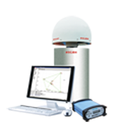
VRS Corrections The “Virtual Reference Station” (VRS) concept is based on having a network (spaced at 50-60kms) of GNSS (GPS or GPS/GLONASS) reference stations permanently connected to a control centre via the Internet. The networked stations collectively and precisely, model Ionospheric errors for the individual GNSS rover in the network coverage area.
Creates Actual Vectors
The rover interprets and uses the VRS network-correction data as if it is operating with a single physical base station on a very short baseline which increases the RTK performance tremendously but it doesn't actually create a virtual vector.
Minimizes the PPM Error Component
Corrections (vectors) are from the closest base, but because the ionospheric error (which is traditionally baseline dependent) is practically negated, the rover's degradation in accuracy due to baseline length starts when the rover is first initialized, that is, at your work site. Thus accuracies are increased and are more consistent throughout the working region.
Calibration and Checks Still Required
Measurement to local control must be performed to ensure that control and coordinates are relative to your job site. A site calibration to the control of your choice yields flexibility and integration into the local grid coordinates.
Traditionally survey activities were conducted entirely by survey crews where quality control - quality assurance was the sole duty of that survey crew. These time-tested procedures must not be over looked. The Can-Net correction system is a only a small shift in survey practice, that being, no base station set-up. Users should still check the quality of the local control and incoming corrections every day.
The Can-Net corrections should be checked at the beginning and end of your survey activities, in accordance with best surveying practices. Since the correction system is so productive, the time savings should be used to validate the correction system. Most users perform a thorough site calibration for a sizable region (town, city, quadrant) only once and copy that site calibration and control in to every subsequent job. New site calibrations can be created for any type of coordinate system (local site, municipal, provincial, or high precision network). Daily use then dictates a simple check into control at the beginning and end of a survey.
New users to RTK surveying must be cautious when using this technology since there are several nuances involved. Satellite tracking is degraded in adverse conditions around structures such as buildings, bridges and forested environments. Also, a condition known as multipath occurs when GNSS signals are reflected from objects such as metal fencing, vehicles, and buildings. Multipath can be a significant error source. In extreme multipath environments getting a fix may be impossible. Training and experience will ultimately optimize your productivity. Please ensure that adequate training is included in your acquisition of this new technology.
Beyond the Basics.... but recapping the basics...
The “Virtual Reference Station” (VRS) concept is based on having a network (spaced at 50-60kms) of GNSS (GPS or GPS/GLONASS) reference stations permanently connected to the control centre via the Internet. The networked stations collectively and precisely, model Ionospheric errors for the individual GNSS rover in the network coverage area.
The rover interprets and uses the VRS network-correction data as if it is operating with a single physical base station on a very short baseline which increases the RTK performance tremendously (but it doesn't actually create a virtual vector). Corrections (vectors) are from the closest base, but because the ionospheric error (which is traditionally baseline dependent) is practically negated, the rover's degradation in accuracy due to baseline length starts when the rover is first initialized, that is, at the work site. Thus accuracies are increased and more consistent throughout the working region.
Advanced explanation of VRS solutions
Solar radiation has a strong electron charging effect on the gases of the earth’s ionosphere. There are short period (24 hrs) and long period (12 year cycle) variations as well as major disturbances in solar radiation. The rapid changes in ionospheric activity does not allow predictive models to be applied.
Precise GNSS positioning requires knowledge of the ionospheric disturbances. The charged particle layer of the atmosphere disperses the GNSS signals. More specifically the phase of the GNSS signal experiences an advance shift and the coded signal experiences a delay. The size of the shift depends upon the degree of ionization along the path from the satellite to the receiver.
These disturbances occur within the ionosphere can be visualized as pierce points along the signal path from the satellite to each ground reference station. Ground reference stations are spaced relatively close to each other at 30-100km. Collectively the groupings of pierce points from one satellite to all ground stations are highly correlated, that is, they experience similar signal shifts. The satellites are typically widely dispersed (100s to 1000s of km) in different areas of the sky. The different pierce point groupings to each satellite are considered independent of one another.
A VRS solution reduces this unpredictability introduced by ionosphere by utilizing a series of local reference stations to correctly reproduce the expected ionospheric characteristics. The total electron content (TEC) on the line of sight between the reference stations in a local network and every GNSS satellite in highly correlated between the stations. This is due the local proximity of the signal rays as they pass through the ionosphere.

The above image was created in Google Earth using a real-time TEC model. It illustrates two satellites and their respective pierce points through the ionosphere over the Southern Ontario Can-Net VRS network. The satellite orbits are shown at about 700km and not the true orbits at 20200km. Note: The satellite orbits are shown at about 700km and not the true orbits of 20200km. This was intentional so that they could fit into the graphic.
Connecting to the VRS Network
When a field user logs into a VRS solution, one of the first pieces of information that is sent (via the NTRIP protocol) is the starting location of the survey. This location (in a NMEA format) is sent to the VRS computing server and a customized correction is created based upon the users location. The delivered real-time correction service has used the collective data supplied by the entire ground network to solve for ionospheric conditions. The result is that the ionospheric degradation in accuracy of the GNSS positioning solution is reduced significantly at the users location. This can then be considered a zero baseline degradation in accuracy from the traditional RTK solution where the ionospheric degradation is typically unknown. The baseline vector from the closest reference station is still solved for but with no ionospeheric degradation.
For a more detailed description of this approach, please refer to the paper A New Method to Model the Ionosphere across Local Area Network in which the above summary has utilized and referenced.
To conclude, the VRS:
- Practically eliminates the ionospheric errors inherent in GNSS measurements and therefore significantly improves your measurement accuracy,
- Requires no base station set up – the base stations are provided by this service and this significantly reduces your start up costs,
- Creates actual vectors between your rover and physical base stations – the “virtual” term is in reference to the ionospheric error elimination process,
- Still requires you to maintain proper surveying techniques such as verifying the received data by doing a site calibration, and
- Can greatly improve efficiency and productivity within your survey business.
|


